How to hike from Porthcothan to Newquay
The hike from Porthcothan to Newquay is one of my favourites on the South West Coast Path in Northern Cornwall. Covering roughly 10-11 miles, you’ll hike past blustery headlands, surfing beaches and hidden coves on an undulating coastal walk to one of Cornwall’s most famous seaside towns.
You’ll find short but sharp climbs into and out of narrow valleys and exposed cliff-top paths – you’ll also pass Park Head and Bedruthan Steps. You’ll hike along expansive sandy beaches at Mawgan Porth and Watergate Bay, before ending in Newquay.
Here’s our step-by-step guide to the full route!
Route Overview & Distance
Porthcothan to Newquay is a distance of around 10-11 miles along the South West Coast Path (each way).
Despite the relatively moderate distance and up-and-down terrain, it’s a well-used and well-marked section of the coast path.
Expect several sharp descents and ascents, and plenty of exposed headlands!
Most hikers complete the route in 5-7 hours.
There are plenty of opportunities to stop for refreshments along the well-developed coast as you near Newquay.
Step-by-Step Directions
1: Portcothan to Park Head
The walk begins at Porthcothan, a small beach set within a narrow valley, around 10 miles north east of Newquay.
From the shoreline, the South West Coast Path climbs steadily out of the cove. It gains height quickly as it leaves the shelter of the village behind.
This first section includes a sustained ascent – following a clear path that winds up the side of the valley before reaching more open ground.
As elevation increases, views stretch along the coastline in both directions – with Trevose Head visible to the north on clear days.
The path then continues along the cliff tops towards Park Head. At around 100 metres above sea level, it opens out to wide views in both directions!
2: Park Head to Bedruthan Steps
From Park Head, the path continues south along the cliff tops towards Bedruthan Steps. Here, you can expect a series of smaller descents and climbs as the route crosses shallow valleys and headlands. This stretch is a little more exposed!
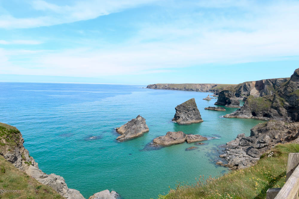
As you approach Bedruthan Steps, the coastline drops dramatically away to reveal a series of spectacular offshore stacks below.
These rather unique rock formations are the result of long-term coastal erosion, which has left isolated pillars standing offshore.
Access to the beach below is restricted due to erosion and safety concerns. Viewpoints from the National Trust coast at Carnewas boast some of the most iconic coastal views in Cornwall.
3: Bedruthan Steps to Mawgan Porth
From Bedruthan Steps, the South West Coast Path continues south, maintaining a high line along the cliffs before gradually descending towards Mawgan Porth.
The descent is more sustained here, with steps and uneven ground in places.
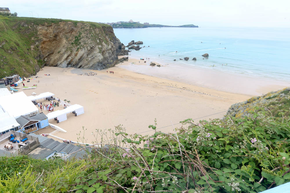
Mawgan Porth is the first major break in the walk. The beach is wide and sandy, with a stream running down to the sea. It’s a sizeable village with plenty of amenities!
It’s also one of the easier points to join or leave the route if you fancy a shorter hike, with the number 56 bus connecting Mawgan Porth directly to Newquay.
4: Mawgan Porth to Watergate Bay
Leaving Mawgan Porth, the path climbs steadily out of the valley. It now returns to the exposed cliff tops!
This ascent is one of the more challenging climbs on the route, but once back on higher ground, the path levels out into a flatter stretch of coastal walking.
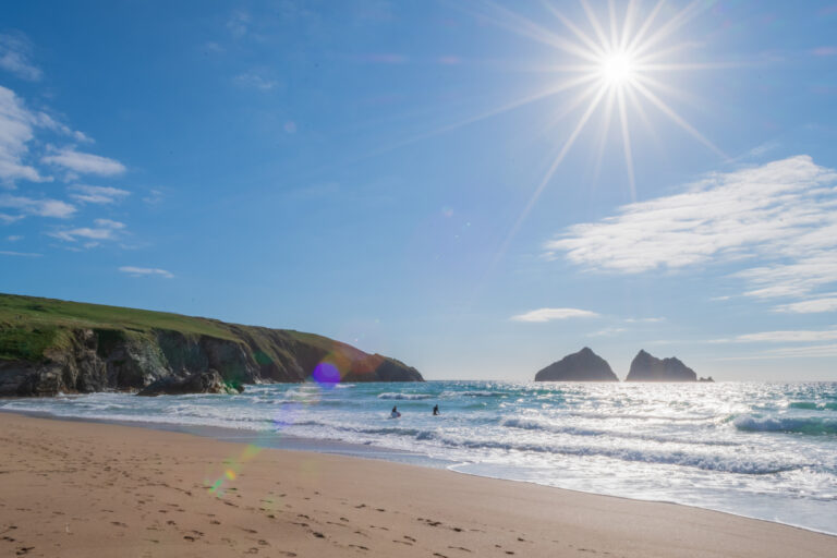
As Watergate Bay comes into view, the landscape opens out towards one of the most expansive beaches in North Cornwall.
The descent towards the bay is gradual, leading down to a wide stretch of sand that stretches for over two miles.
At Watergate Bay, the coastline also becomes far less isolated.
There’s much more development here as you near Newquay, and the Watergate Bay Hotel is the perfect place to stop off for a cold beer with excellent sea views.
5: Watergate Bay to Newquay
From Watergate Bay, the final section of the walk continues south towards Newquay.
The path rises gently out of the bay before settling into a more gradual stretch with fewer steep climbs than earlier sections!
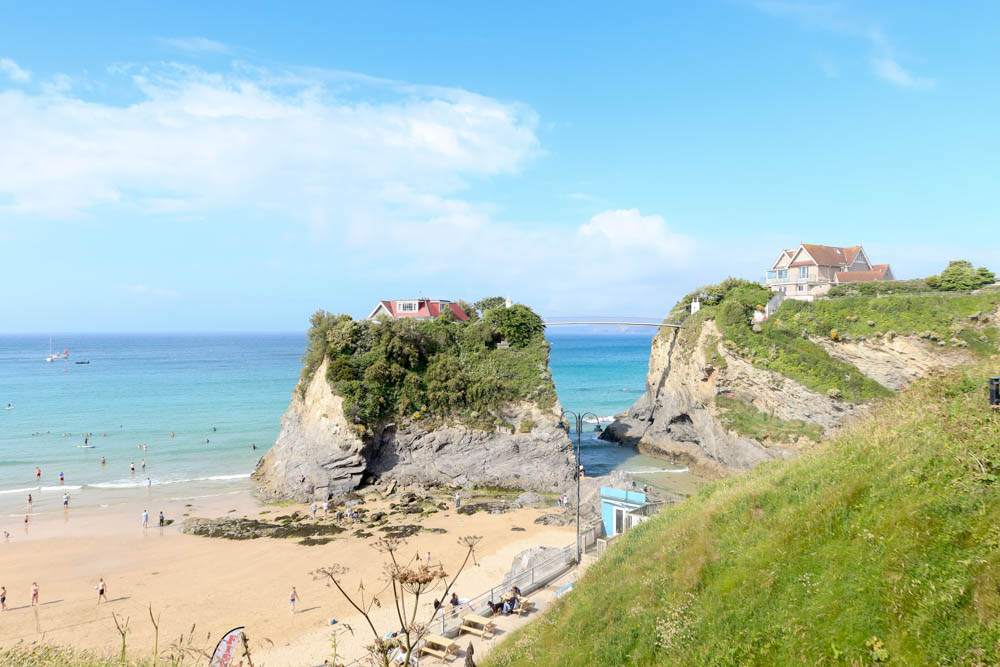
As the route progresses, you’ll enter Newquay’s suburbs, where the sense of remoteness gives way to the urban setting. You’ll pass some of Newquay’s most famous beaches on your way into the town centre, including Lusty Glaze and Tolcarne Beach.
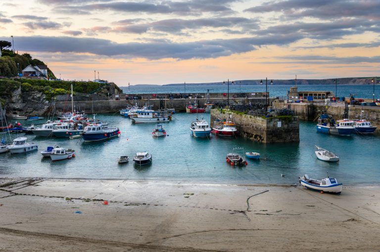
Towan Head marks the entrance to Newquay’s harbour, and from here, the path continues onwards to the iconic Fistral Beach. You can end your walk at any point in Newquay!
👉 The next hike is Newquay to Perranporth, and we have a guide to that too.
Terrain & Difficulty
The hike from Porthcothan to Newquay is moderate in difficulty. You’ll have plenty of ascents and descents along the way, with an elevation gain of around 400-500 metres across the full 10 to 11-mile route.
Much of the route follows cliff-top paths, which are often exposed to the winds. Underfoot, the path is well defined but can be rocky in places and muddy after heavy rains.
Refreshments & Toilets
Facilities along this stretch of the South West Coast Path are more regular than others, particularly as you near Newquay.
Key refreshment and toilet stops include the following:
- Porthcothan: seasonal facilities including toilets and a small shop/café near the beach.
- Mawgan Porth: the main mid-route stop, with cafés, pubs, shops, and public toilets.
- Watergate Bay: several restaurants, hotels and cafés overlooking the beach.
- Newquay: full range of amenities, including toilets, supermarkets, and plenty of places to eat
Getting there and back
We love this stretch of the South West Coast Path because it’s surprisingly easy to access both the start and end points of the hike.
Newquay is the best place to base yourself, with the town being North Cornwall’s gateway (there’s a train station that connects to Par for the main line and even an airport).
The number 56 bus runs between Newquay and Padstow, with stops at Watergate Bay, Mawgan Porth and the start/end point at Porthcothan.
The bus runs irregularly, however, so make sure you check the timetable and plan your hike in advance.
We’d recommend riding the 56 to the start line at Porthcothan, then walking back to Newquay. You can also drive to Porthcothan and park by the beach, but then you’ll have to take the bus back anyway to fetch your vehicle after the hike!
Planning tips & safety
- Check the weather before setting out. Tackling exposed headlands in strong winds or rain is never much fun! Take sunscreen and wear a hat in hot weather.
- Start early and allow enough time. The hike takes a minimum of 5 hours.
- Check the bus timetables if you’re taking public transport.
- Carry sufficient food and water, as there are several long sections without facilities.
- Wear appropriate footwear for uneven ground.
- Hiking poles will help you out on the steeper ascents/descents.