Best places for walking holidays in the South West
I’m biased, but I think that the South West is the best area of the country for hiking.
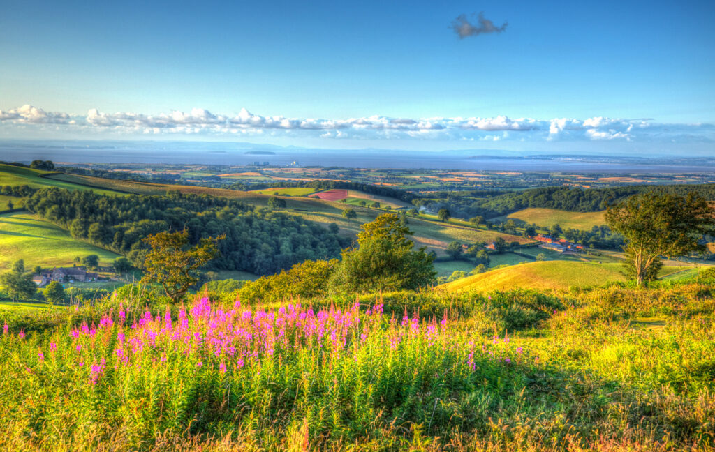
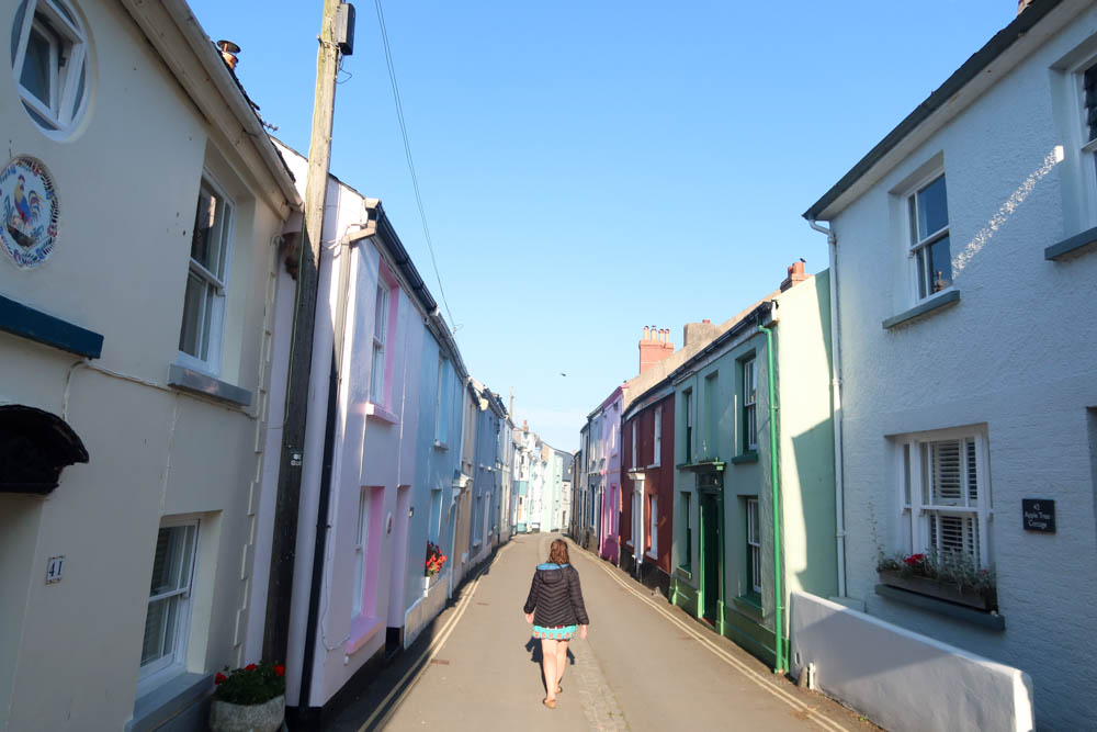
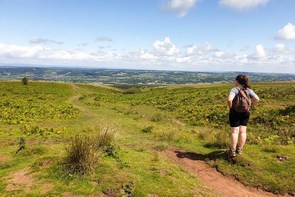
Footpaths here climb over open moorland, trace the tops of sea cliffs and run between old stone cottages in historic villages.
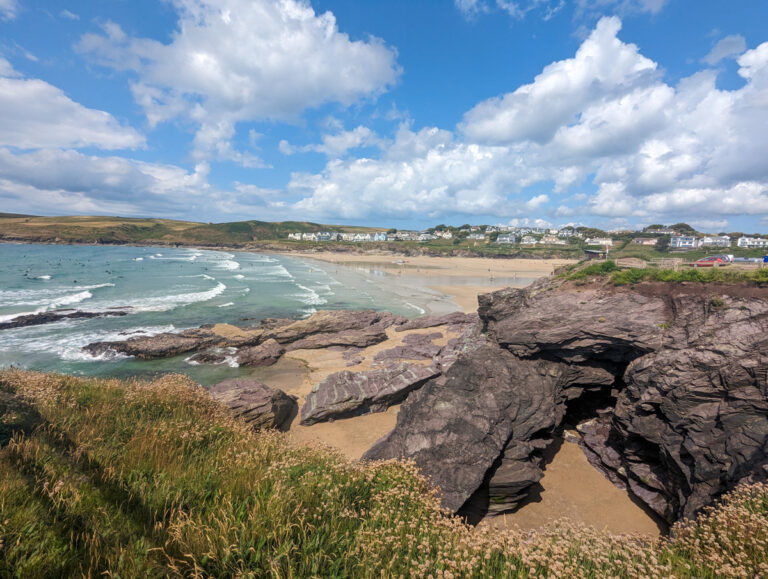
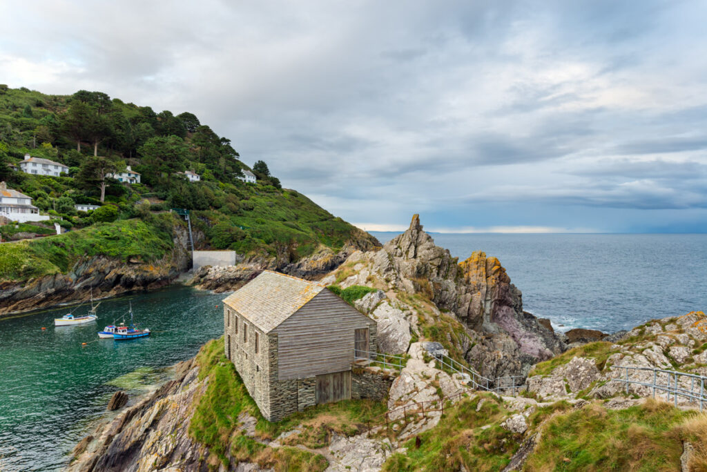
The South West Coast Path traces over 600 miles of coastline. Inland, trails lead through the granite tors of Dartmoor National Park and the wooded valleys of Exmoor National Park, with waymarked routes linking villages like Clovelly, Porlock Weir and Branscombe.
Self-guided walking holidays with Walk With Williams give you the chance to explore these landscapes without worrying about logistics.
They plan multi-day routes, book your accommodation and move your bags between stops, leaving you free to walk with just a daypack. Their itineraries focus on quiet stretches of coast and lesser-known inland paths, with daily distances tailored to leave time for farm shop stops, cream teas or detours to ancient ruins.
Whether you want short village-to-village strolls or week-long hikes, the region’s variety of terrain makes it easy to match the route to your pace and interests!
Here are some fantastic long-distance hiking trails you can try with Walk With Williams.
The Cotswold Way

The Cotswold Way runs for 102 miles from Chipping Campden to Bath. It crosses a ridge of limestone hills dotted with medieval wool towns and centuries-old inns. The path climbs gently between market squares and open hilltops, giving wide views over patchwork farmland and wooded valleys.
Through Broadway, you walk past Georgian-fronted houses towards the hilltop Broadway Tower, while in Winchcombe the route skirts the gates of Sudeley Castle.
South of Painswick, it threads between ancient beech woodland and dry-stone walls before dropping down to the crescents and Roman baths of Bath. Waymarks are frequent, and most stages are 10–15 miles, so it’s a trail manageable trail even without long-distance experience.
Jurassic Coast Walks
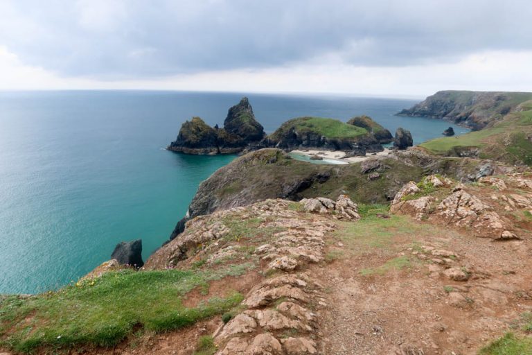
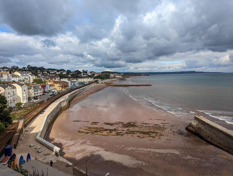
The Jurassic Coast stretches for 95 miles between Exmouth in Devon and Studland Bay in Dorset, following cliffs that expose 185 million years of geological history. It’s a string of linked trails, many forming part of the South West Coast Path. The terrain varies from low sandstone cliffs to high chalk headlands, with steep climbs broken up by villages and coves.
From Exmouth, the path crosses the red sandstone cliffs to Budleigh Salterton and Sidmouth, where fishing boats sit on the pebble beach below Regency terraces. Then it travels to Branscombe and Beer (two of my favourite Devon villages!).
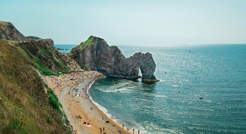
East of Seaton, the undercliffs near Axmouth form a dense tangle of woodland that feels cut off from the world. In Dorset, the trail climbs over the fossil-rich shingle of Charmouth, then along the golden cliffs to West Bay. The eastern end includes the steep chalk cliffs around Durdle Door and the sheltered cove at Lulworth Cove.
Villages along the route have plenty of places to stay and eat, from guesthouses in Beer and Lyme Regis to beach cafés in Burton Bradstock and West Lulworth.
It’s easy to split the Jurassic Coast into short stages of 6–12 miles, or walk individual sections as day hikes using buses or local trains to link start and end points.
See my full guide to the Jurassic Coast.
Two Moors Way

The Two Moors Way crosses 102 miles between Wembury on the south coast and Lynmouth on the north coast, linking Dartmoor National Park and Exmoor National Park. It’s one of the few trails that cuts directly across Devon, moving from the granite tors and wide heather moorland of Dartmoor to Exmoor’s steep-sided valleys and coastal cliffs.
Just a note: Devon’s a large county, so expect this to take a while!
The route is waymarked and mostly moderate. However, navigating on the moors is a challenge and shouldn’t be taken lightly!
On Dartmoor, the path passes Widecombe-in-the-Moor, Postbridge and Chagford, where stone inns sit on village greens. North of Witheridge, it follows quiet lanes and wooded streams through mid-Devon before climbing onto Exmoor near Withypool and Simonsbath.
The final stage drops from high moor to the harbour at Lynmouth, where the trail meets the South West Coast Path.
South West Coast Path
The South West Coast Path runs for 630 miles from Minehead in Somerset to South Haven Point in Dorset, tracing the entire coastline of Devon and Cornwall along the way. It’s the longest National Trail in England.
I hiked half of it in summer 2021, and as I live in Exmouth now, every few months I’ll dig out my Solomons hiking boots and head to paths around me again. One day I’ll complete it all!
Walking the trail, you’ll find steep cliff climbs, wooded estuaries, remote headlands and sheltered coves – often within a few miles of each other!
The eastern section from Exmouth to Studland Bay is the Jurassic Coast (already mentioned)
The full route takes most walkers 7 to 8 weeks, but it’s easy to walk it in shorter sections. Regular villages, B&Bs and beach cafés make it simple to break into day stages of 6–15 miles.
Good sections to try:
- Minehead to Westward Ho! (about 90 miles): Wild cliffs through Exmoor National Park, the tidal crossing at Instow, and the surf beaches of North Devon. Usually 7–8 days.
- St Ives to Falmouth (about 115 miles): Remote Atlantic cliffs, passing Land’s End, Penzance and The Lizard, the southernmost point of mainland Britain. Around 9–10 days.
- Plymouth to Exmouth (about 120 miles): Rolling wooded valleys, estuary ferries and sheltered coves on the South Devon coast, passing Salcombe, and Torquay. About 9–10 days.
- Lyme Regis to Studland Bay (about 95 miles): The full Jurassic Coast, with fossil cliffs at Charmouth, sea stacks at Old Harry Rocks, and sweeping beaches at Weymouth. Usually 7–8 days.
- See my full guide to the South West Coast Path.
Coleridge Way
The Coleridge Way runs for 36 miles from Nether Stowey on the Quantock Hills to Porlock on the Exmoor National Park coast, following routes once walked by poet Samuel Taylor Coleridge.
The Quantocks were England’s first AONB (Area of Outstanding Natural Beauty) and they’re often forgot about when compared to other scenic spots throughout the country!
This trail links oak woodland, open moorland and deep green valleys, with long views across the Bristol Channel on clear days. The path is waymarked and mostly gentle, with some steeper climbs on the Exmoor stretch, making it manageable for walkers with moderate fitness.
From Nether Stowey, where Coleridge lived while writing The Rime of the Ancient Mariner, the trail climbs the Quantock ridge through Holford and West Quantoxhead, then drops into the wooded valleys around Roadwater and Luxborough.
The final section crosses Exmoor’s heather slopes to Porlock, where it meets the South West Coast Path.
See my full guide to the Quantocks.
Tarka Trail
The Tarka Trail runs for 180 km in a figure-of-eight loop through North Devon, following the route described in Tarka the Otter by Henry Williamson. If you want an easy first long-distance walk, start with the 48 km southern stretch between Braunton and Meeth. It uses a former railway line, so you’ll walk on level, traffic-free paths as the route winds beside estuaries and through wooded cuttings.
The northern loop climbs over the high ground of Exmoor National Park and is more of a challenge!
You’ll pass old railway bridges, deep-cut valleys and wide saltmarshes where curlews and egrets feed. The estuary path from Barnstaple to Instow boasts long views across the River Taw, while the route from Bideford to Great Torrington stays enclosed in green woodland.
Most people walk or cycle the southern section in half-day or full-day stretches, and you can join or leave the trail easily using the train at Barnstaple or buses from Bideford and Torrington. If you want a longer challenge, plan the full loop as a 7–9 day walking holiday.
Mendip Way
The Mendip Way runs for 50 miles across Somerset, from Weston-super-Mare on the Bristol Channel to Frome near the Wiltshire border.
It’s split into two sections: the 30-mile West Mendip Way and the 20-mile East Mendip Way. The western half crosses the limestone hills of the Mendip Hills, while the eastern half drops through wooded valleys and old quarry towns.
If you start from Weston-super-Mare, you’ll climb through open farmland towards Crook Peak and along the dramatic ridge of Wavering Down.
The path then passes through Cheddar Gorge, where sheer cliffs rise above the village, before reaching the market town of Wells with its Gothic cathedral and medieval streets.
From there, the East Mendip Way heads through hidden combes, past disused railways and quarries, and down to Frome.