Exmouth to Otterton Circular Hike
This Exmouth – Otterton circular hike is perfect for anybody wanting a day hike that takes in a range of East Devon’s spectacular scenery.
This route takes parts of a few different trails to make a circular route. Moorland, cliffs, picturesque villages and wide sandy beaches in one day? I’m in!
I’m an Exmouth local and have done this hike, and adaptations to it, numerous times.
So, here’s how to do an Exmouth to Otterton circular hike.
Exmouth to Otterton Circular Hike: The Route
- Distance: Approx. 30 km / 18.6 miles
- Time required: 7–9 hours depending on pace and stops
- Start/end point: Anywhere in Exmouth (or Budleigh Salterton/East Budleigh if adapting)
- Type: Circular route combining moorland, village lanes, river paths, and clifftop coast
Exmouth
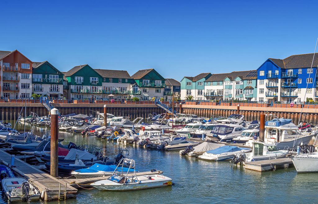
The hike can begin wherever you’re staying in Exmouth. If you’re in Budleigh Salterton or East Budleigh, you can start there too of course.
You need to walk up to the St John in the Wilderness Church, which is about 20 minutes from the Brixington TESCO metro. This map explains it a bit better.
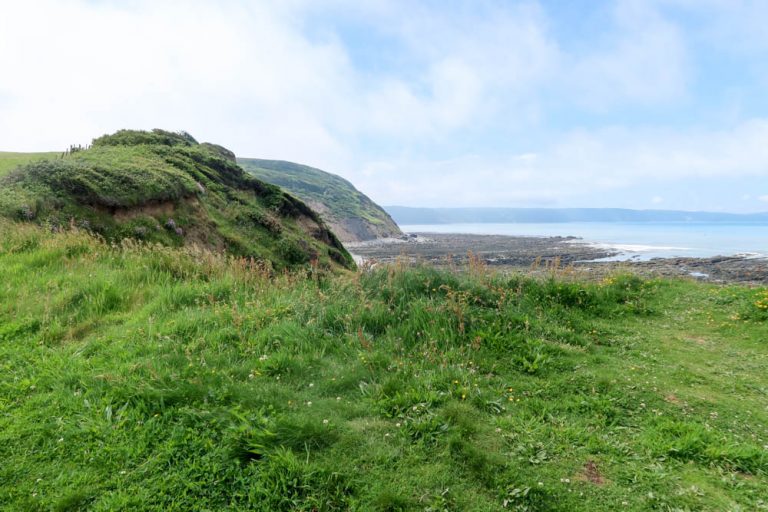
Carry on climbing the hill until you reach the moorland.
Now you have the chance to take a variety of different routes – there are quite a lot of interconnecting paths that will take you to East Budleigh. I recommend downloading maps.me and following one of the trails there.
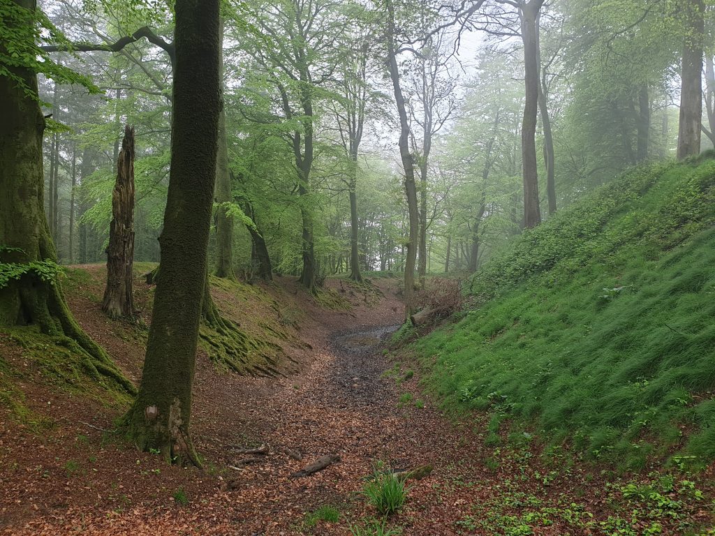
The St John in the Wilderness to East Budleigh segment should take between 1 hour – 1.5 hours, depending on which trail you take. It’s 3.5 miles/ 5.6 kilometres on the shortest route. Here’s a map.
East Budleigh
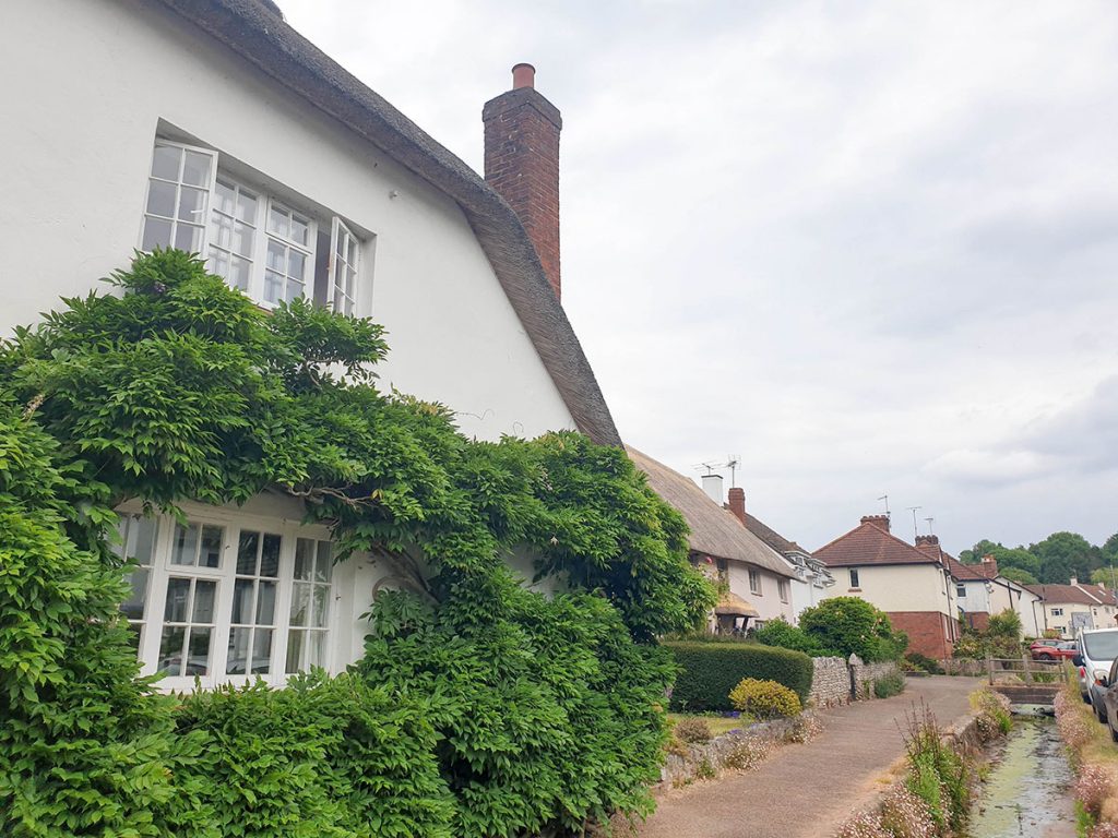
Eventually, you should reach East Budleigh. This is a small village famous for being the hometown of Sir Walter Raleigh. There’s a statue in his honour, and if the church is open, you can pop in and find the pew dedicated to his family.
East Budleigh is one of those villages that looks like it’s in a time warp; the streets are lined with thatched roof cottages and there’s only a small convenience store and one pub. Once you’ve taken in the village, continue to Otterton.
We didn’t find a path to take us to Otterton. Instead, we ended up just walking along the country road – slightly nerve-wracking, but it was quiet! It’s not far from East Budleigh to Otterton, just a bit traffic-y.
Google maps says that the distance is 0.9 miles or 1.4 kilometres, and it should take about 20 minutes to walk. Check out this map.
Otterton
Otterton Mill is the most important part of this village. There has been a mill in the same spot since Norman times, and it acted as a working mill until the 20th century. It fell gradually into disrepair, but was restored in the 1970s. Nowadays it again acts as a working mill, with lots of reminders of its past!
The River Otter runs from Budleigh Salterton up to Otterton – there’s a fascinating story about this segment. Beavers (not otters, as the name may imply) popped up in the area – and nobody knows how, as they had been extinct in the UK wild for 500 years. They were permitted to stay for five years, while the council worked out what to do with them, but luckily they have recently been allowed to remain permanently.
There are beaver walks available in Otterton – you probably won’t be there at the right time of day on your hike, but they are worth doing if you can come back for them!
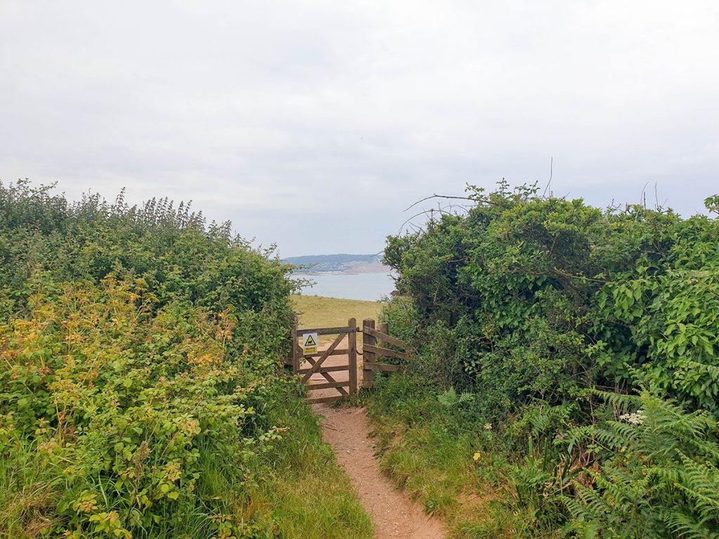
From Otterton, continue in a southeasterly direction to take you to Ladram Bay. It’s about 1.1 miles or 1.7 kilometres to get there and should take a bit longer than half an hour. Here’s a map.
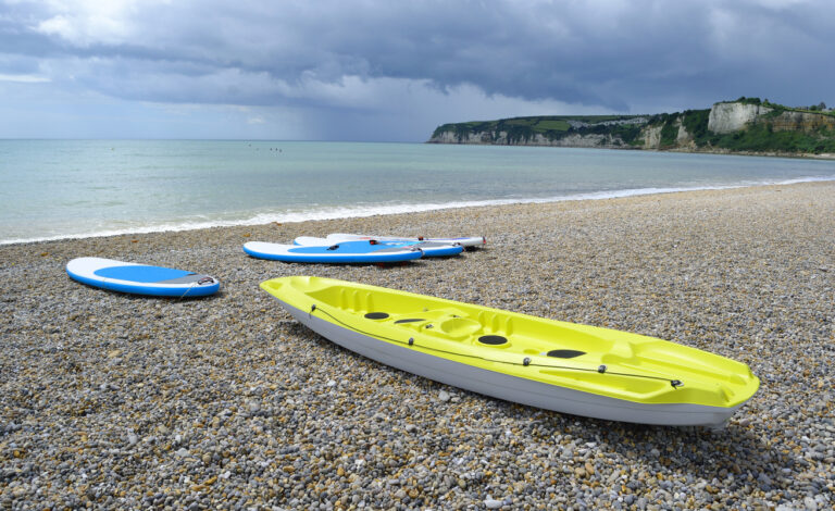
Ladram Bay
You’ll go through some foot trails until you eventually see the sea – keep following it, and you’ll come to Ladram Bay. This is a small, quiet cove on the Jurassic Coast, mainly taken up by a holiday park. It’s gorgeous, so you might want to tuck into a picnic lunch here while you enjoy the view!
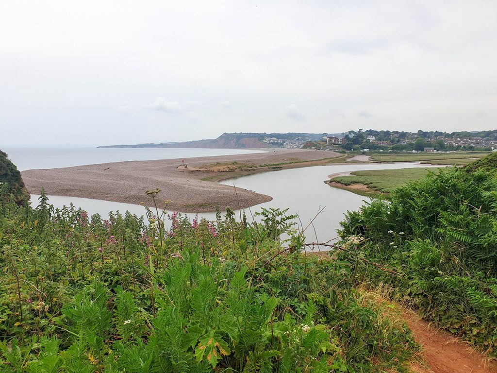
Follow the cliff tops to Budleigh Salterton. It’s 4.3 miles, or 6.92 kilometres, to reach the town. Once you reach the River Otter, you will have to walk upstream for a kilometre or so to cross, and then walk back towards the bridge. It will take about an hour and a half. Here’s the map.
Budleigh Salterton
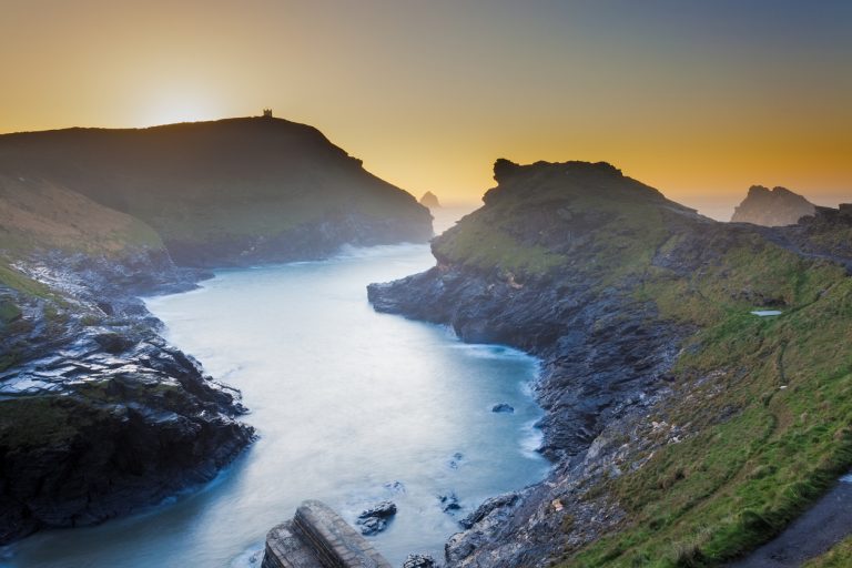
The remainder of the walk will just take you along the sandstone cliffs of the famous Jurassic Coast. Ending in Exmouth, this 95 mile stretch takes you down to Bournemouth and passes through some of the UK’s best coastal scenery. But you’ll just be walking the last few miles of it – and this part is the oldest segment of some ancient cliffs.
Budleigh Salterton isn’t as big as Exmouth, but it does have a co-op, Tesco express and a spar, as well as several restaurants if you need to get some snacks or a drink. The beach is pebbled – not as fun as Exmouth’s sand beach – but there are plenty of benches to sit on and enjoy the vista.
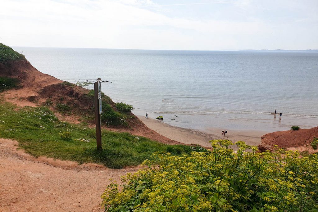
Follow the cliffs again to reach Exmouth. This is the longest segment of the journey; it’s about 5.4 miles or 8.7 kilometres – it will take you around two hours. Click here for a map.
Exmouth
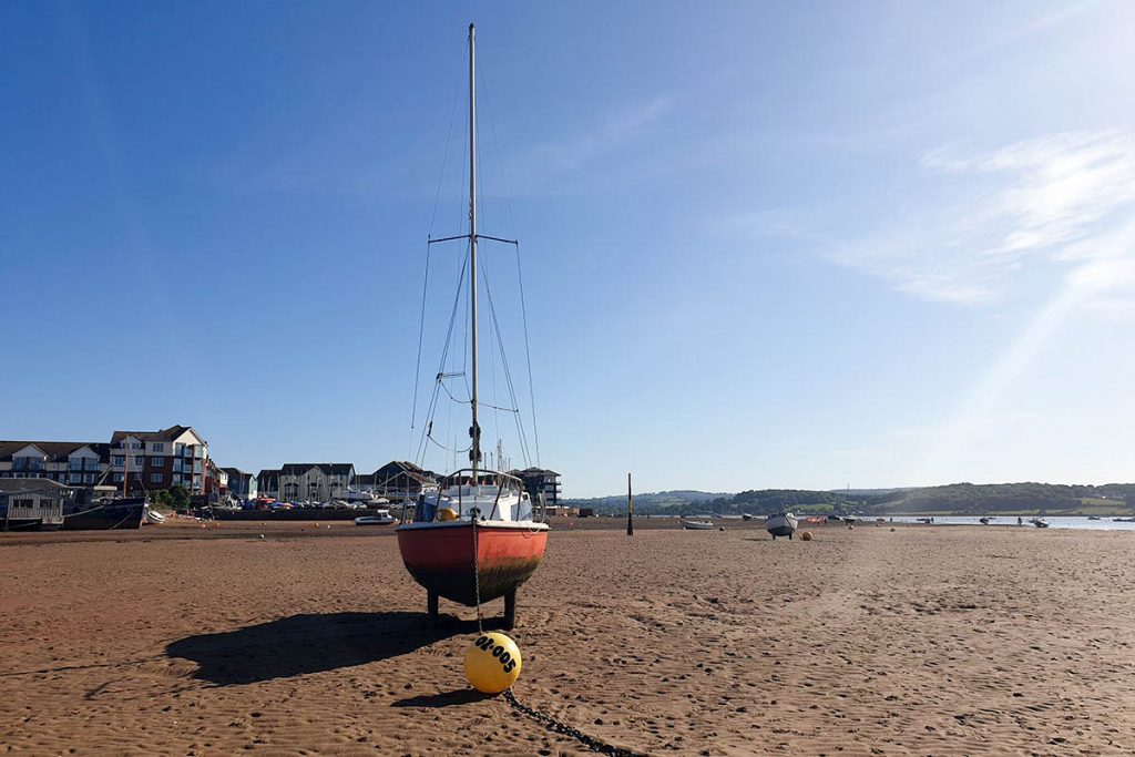
Over the cliffs another time, and you’re back in Exmouth!
Don’t miss the Geoneedle, which marks the official start of the Jurassic Coast. All of Exmouth’s highlights are here – the sandy beach, ice cream shops, cafes, fish and chips… so you can have a well-deserved rest and recoup after hiking 30 kilometres!
For more inspiration, check out my things to do in Exmouth post.
From the beach, you can just walk back to wherever you are staying in Exmouth. If you want a few drinks to celebrate completing the hike, I recommend The Grove.