7 incredible cliff views in Cornwall
Cornwall’s coastline is definitely not short on drama.
From wave-battered headlands to quiet granite outcrops, the best cliff views in Cornwall reward those willing to take a few extra steps from the car park!
Here’s where to go for some of Cornwall’s most impressive cliffs.
Best cliff views in Cornwall
Cape Cornwall
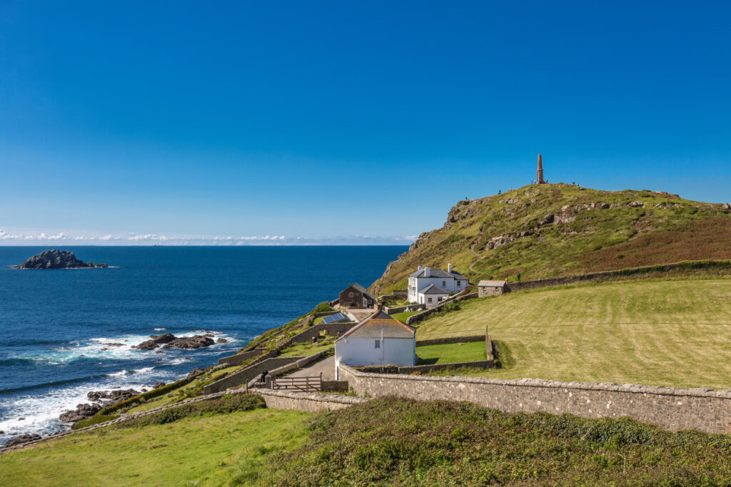
While nearby Land’s End draws the crowds, Cape Cornwall feels wild.
The view from the summit takes in the Brisons – two jagged offshore islets – and long stretches of Atlantic coast in both directions.
Climb the short path up from the National Trust car park and you’ll pass a distinctive chimney stack,n which is the last trace of the Cape Cornwall Mine.
The surrounding land is open access, so you’re free to wander beyond the coastal path. Late afternoon is the best time to visit – this is when the low sun hits the sea directly behind the Brisons.
Pentire Point and the Rumps
This is the spot locals often recommend when asked where to go for coastal views.
From Polzeath, walk north-west up onto Pentire Point and follow the path as it curves out towards the twin-headed outcrop of the Rumps.
It’s quieter than anywhere else nearby, and the views sweep across Padstow Bay to Trevose Head.
The clifftop itself is tiered with grassy ledges and traces of an Iron Age hill fort.
Walkers often pause here to scan the sea for dolphins or seals – the deeper waters off the headland are a regular feeding zone. To turn it into a circuit, continue to Port Quin and loop back inland through fields and lanes.
Zennor Head
A sharp, angular headland west of St Ives, Zennor Head is an easy detour from the coast path – or a focused destination in itself.
You’ll climb from the cove at Pendour along well-maintained steps, rising fast to a plateau with steep-sided cliffs on three sides.
Here, you can enjoy uninterrupted views towards Gurnard’s Head and Trevega Cliff.
This part of the coastline often sees choughs and kestrels, and the surrounding slopes bloom with sea pinks and heather in spring and early summer.
Access is from Zennor village – park near the church and follow the footpath down towards the coast.
Lizard Point
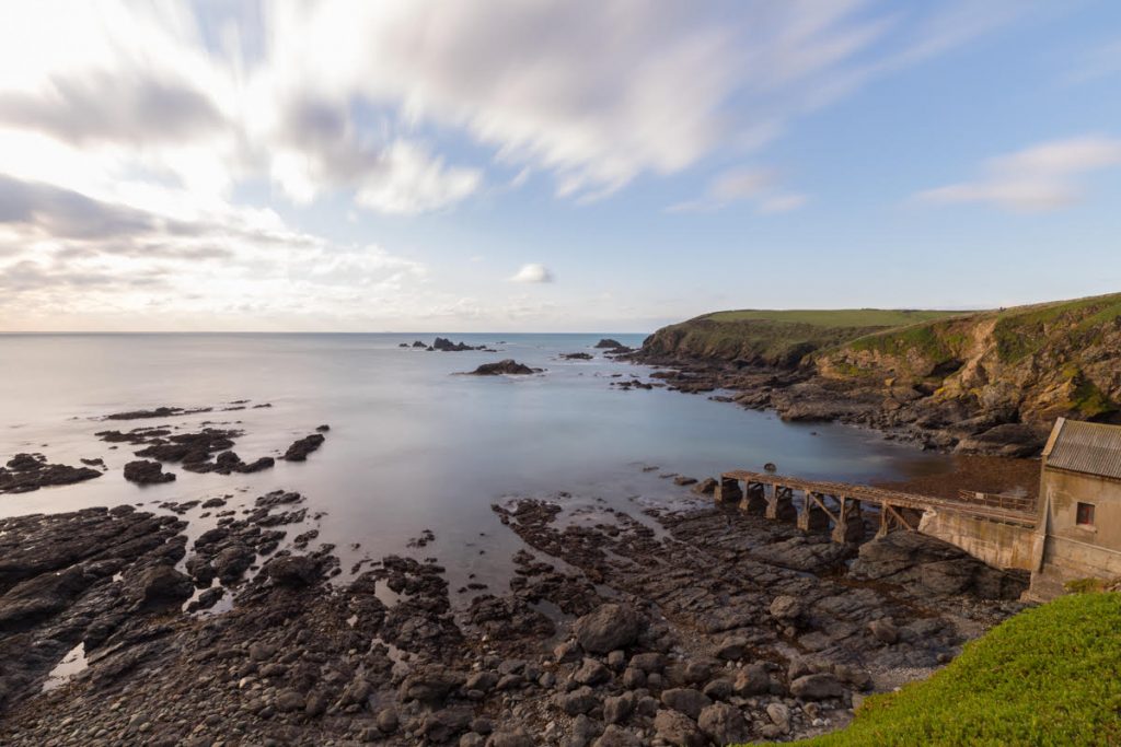
Britain’s southernmost point is a spectacular place to stand.
The cliffs drop sharply to sea level, where churning waters circle exposed rock stacks.
The coastal path here heads both east and west, but the best view is right near the Lizard Lighthouse, especially in the early morning when fishing boats head out to sea.
To the west, the route soon climbs up to Housel Bay, where an optional loop detours via the rare serpentine rock formations.
In spring and autumn, this area also becomes a hotspot for rare migrant birds – bring binoculars if that’s your thing!
Bedruthan Steps
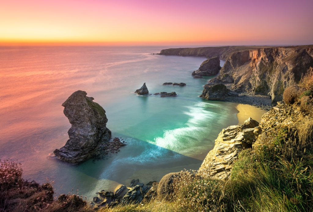
Strictly speaking, the “steps” are the tall rock stacks in the sea, not a path down to them — although there was one until landslides permanently closed the cliff stairs in 2019. You can no longer access the beach.
But have no fear – the view from the clifftop remains intact and is arguably better anyway.
Park at Carnewas and follow the coast path – every few hundred metres brings a new vantage point. You’ll see towering stacks that resemble giants striding through the surf, best viewed around mid-tide when they’re partially surrounded.
Sunset is popular here, but visit mid-morning on a weekday for fewer people!
Dodman Point
The highest headland on Cornwall’s south coast rises above Vault Beach and protrudes dramatically into the Channel.
From the stone cross at the point, you can trace the curve of the bay round to Mevagissey and Portmellon. On clear days, the Eddystone Lighthouse can be spotted far offshore.
The walk here is quieter than the north coast hotspots and the landscape feels more pastoral. You’ll pass through old field systems, flower-rich grassland and small wooded sections before emerging onto the cliffs.
For the best view, stand beside the coastguard lookout and face east — there’s often a sea haze in the early afternoon that lifts towards dusk.
Portloe to Nare Head
This under-visited stretch of the Roseland Peninsula doesn’t get the fanfare it deserves.
The cliffs here are tall, rugged and often empty of walkers (although it is getting busier in the summer).
Starting from the fishing village of Portloe, follow the coast path eastwards and you’ll soon reach an exposed section with panoramic views south across Veryan Bay.
About an hour in, the path crests Nare Head itself. There’s a Cold War-era observation bunker at the summit – it was built in July 1963 for the Royal Observer Corps and was accessed via a 12-foot ladder into an underground complex capable of sheltering three people for up to three weeks while monitoring nuclear blasts and fallout. It’s open occasionally for tours.
Even when it’s closed, the view is exceptional – looking west towards Dodman Point and east to Gull Rock and the beaches around Carne and Pendower.