This road trip helps you see another side to Cornwall
Sitting, brooding in the centre of Cornwall, Bodmin Moor is the antithesis to its bright, sunny beaches.
But for me, Bodmin Moor is part of what makes Cornwall so alluring. The Duchy is many-sided, and a Bodmin Moor road trip can you show that!
This road trip takes two days, with a suggested stay at Jamaica Inn (you could book one, two or three nights there).
Let’s dig into it!
Day one: Golitha Falls to Altarnun
Golitha Falls
There’s a free car park just off Draynes Bridge. It’s run by Inkie’s Smokehouse, a restaurant in the car park, who ask that anyone parking order something from the cafe (they open at 10:00am).
Just beside the car park, a flat woodland trail runs alongside the River Fowey. The falls appear in sections rather than one dramatic drop – they’re a series of fast-moving channels tumbling over moss-covered granite.
The footpaths are mostly well-defined but can be slippery after rain. Keep an eye out for the twisted oaks and exposed roots.
You don’t need to spend a huge amount of time here – you’ll see most of it in around an hour.
See my guide to Golitha Falls.

Siblyback Lake
From here, drive ten minutes to Siblyback Lake. The full lakeside loop is five kilometres, but you can shorten the stop by heading to the lakeside café and walking out along the causeway for views over the open water.
In spring and autumn, the lake is popular with paddleboarders and dog walkers. There’s ample parking and toilets beside the activity centre.
Minions
Continue to Minions, the highest village in Cornwall. Park by the old engine house or near the heritage centre. From here, walk past the three stone circles known as The Hurlers and follow the path up to The Cheesewring — a natural stack of granite slabs shaped by centuries of weather.
The route is exposed but short. The entire loop can be done in under an hour, though you’ll likely pause for photos at the summit.
Nine Stones Stone Circle
The next stop is the Nine Stones Stone Circle, about a 20-minute drive north. It’s a small, often-missed circle tucked just off the A30.
There’s a layby nearby and a short path leads to the site. The setting feels remote, bordered by rough grass and scattered gorse.
There’s no signage or visitor infrastructure, and it’s rare to see anyone else here.
Alturnun
End the day in Altarnun, a few miles to the east. The stone bridge crossing the stream, the 15th-century church, and the surrounding cottages make this one of the moor’s most photogenic villages.
If the church is open, it’s worth stepping inside to see the carved bench ends and wagon roof.
The village lanes are narrow and parking is limited, but there’s a small space by the church. From here, it’s a ten-minute drive to Jamaica Inn.
Jamaica Inn
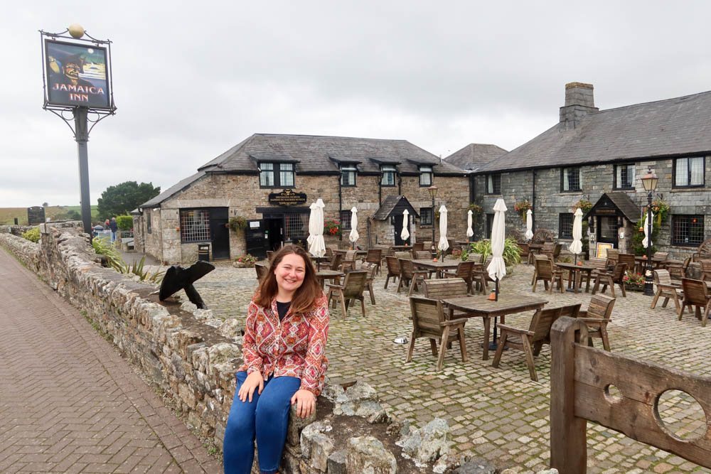
Jamaica Inn sits just off the A30 at the edge of the moor, surrounded by open fields and low stone walls. The building dates to 1750 and was originally a stop for changing horses on the Bodmin to Launceston turnpike.
Its history is linked to smuggling — contraband was moved across the moor from Cornwall’s south coast, stored in hidden cellars, and passed on via packhorse routes.
Inside, low beams, slate floors and open fires have been preserved, with a museum covering its smuggling past and connections to Daphne du Maurier, whose 1936 novel made the inn famous.
The bar serves food all day and is open to non-residents.
Rooms are modernised but retain original features, including thick stone walls and deep-set windows. There’s free parking on-site and easy access to both east and west Bodmin Moor.
See my full guide to Jamaica Inn here.
Day two: Jamaica Inn to Rough Tor

Begin the day at Jamaica Inn. If you didn’t visit the museum yesterday, this is the best time to do it.
Exhibits cover the inn’s history, links to smuggling routes, and Daphne du Maurier’s connection to the building.
There’s a small gift shop and plenty of parking on-site. Breakfast is served in the main bar or attached café.
King Arthur’s Hall
Drive north through Bolventor towards St Breward.
The road narrows and visibility drops across the moor.
There’s no signage to King Arthur’s Hall, so make sure your maps are loaded before setting off – although I actually had very good signal when I arrived at the site.
Drive to where the road ends and then it’s around a 10 minute walk to the site. The site itself is a rectangular arrangement of standing stones, set in a shallow basin and surrounded by reeds and moor grass.
It’s very isolated, but it’s rugged, raw and very Bodmin Moor.
Rough Tor

From here, continue to the main Rough Tor car park.
The walk from the car park to the summit takes 30–45 minutes, with a steady incline across granite-studded heath. The remains of Bronze Age hut circles are visible along the lower slopes.
From the top, you’ll get open views across the northern moor and towards the Atlantic coast.
See my guide to climbing Rough Tor.
If conditions are dry and time allows, continue to Brown Willy, the highest point in Cornwall.
The extra walk adds around 90 minutes return, with boggier ground in places and no marked path.
Return via the same track. The car park has no toilets or services. From here, it’s a 25-minute drive back to Jamaica Inn.
Tips for exploring Bodmin Moor
- 🥾 Wear proper walking shoes – Even short trails like Cheesewring and Rough Tor cross uneven, often boggy ground. Paths aren’t always maintained and granite underfoot gets slippery when wet.
- 📱 Download offline maps – Mobile signal is patchy across most of the moor. Apps like OS Maps or AllTrails are useful, especially for finding places like King Arthur’s Hall.
- 🚗 Fuel up in advance – There are no petrol stations on the moor itself. Fill up in Launceston, Bodmin, or Liskeard before heading in.
- 🚻 Public toilets are limited – Siblyback Lake has facilities, but most sites (like Rough Tor or Minions) don’t. Plan accordingly.
- 🌦️ Check the weather before setting out – Fog and low cloud can roll in quickly, especially around Rough Tor and Brown Willy. Visibility drops fast and temperatures can feel several degrees lower than nearby towns.
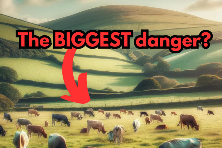
- 🐑 Expect livestock on the roads and trails – Ponies, sheep and Highland cattle roam freely. Drive slowly and close gates behind you on footpaths.
- 📸 Avoid sunrise or sunset at remote sites unless you know the area – There’s little lighting, few landmarks, and no mobile signal. If you’re keen to photograph these times, scout the location during daylight first.