This devastating flood almost wiped out Bristol
On 30 January 1607, a catastrophic flood swept through the Bristol Channel and Severn Estuary, leaving a trail of destruction that reshaped South West England and parts of Wales.
With little warning, towering waves breached defences, swallowed entire villages and surged as far inland as Glastonbury Tor – 14 miles from the coast.
Over 2,000 people drowned, and 200 square miles of farmland were left underwater, crippling local economies and devastating communities.
What caused this disaster remains a topic of debate centuries later.
Was it a storm surge fueled by a fierce south-westerly gale, or a rare tsunami triggered by seismic activity?
Regardless of its origin, the Great Flood of 1607 was one of the most devastating natural disasters in British history.
The day the sea rose: What happened on 30 January 1607?
It began around noon, as the tide surged into the Bristol Channel with unprecedented force.
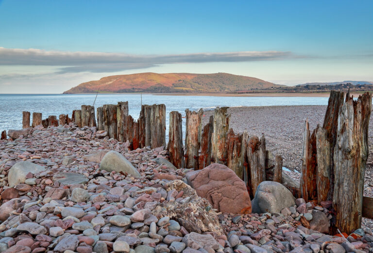
The floodwaters reached far beyond the usual boundaries and inundated low-lying areas across Somerset, Devon, Gloucestershire and South Wales.
Cardiff saw the foundations of St Mary’s Church destroyed, while Burnham-on-Sea’s sea wall gave way, unleashing a torrent across the Somerset Levels.
Thirty villages in Somerset alone were affected, with Brean suffering particularly badly: only two of its nine houses remained standing, and 26 of its residents perished.
In Kingston Seymour, the floodwaters rose to an astonishing height of 7.74 metres (25 feet) above sea level – this mark is still chiselled into the walls of All Saints Church.
And for ten days, the church remained submerged in five feet of water.
The devastation

The Great Flood of 1607 was a disaster that left entire communities in ruins.
The death toll reached over 2,000, making it one of the deadliest natural disasters in British history.
The floodwaters consumed an estimated 200 square miles (51,800 hectares) of farmland, destroying crops and killing thousands of livestock.
For rural communities dependent on agriculture, this devastation was catastrophic.
The inundation also salinated the soil, rendering it infertile for years.
The economic repercussions rippled across the region. Fishing, farming and trade – all cornerstones of the local economy – were crippled.
Many coastal towns, reliant on maritime industries, suffered significant setbacks, with ports damaged and boats destroyed.
The flood reshaped the physical and economic landscape of the region, leaving scars that would endure for generations.
What caused the flood? The storm surge vs tsunami debate

For centuries, scholars and historians have debated the true cause of the Great Flood of 1607.
Most evidence points to a powerful storm surge, a combination of high spring tides and a fierce south-westerly gale.
Historical meteorological data suggests that the tide reached a height of 7.86 metres (25 feet 9 inches) on that day, exacerbated by low atmospheric pressure and strong winds pushing water into the narrowing Bristol Channel.
However, an alternative theory emerged in 2002, proposing that the flood was caused by a tsunami.
Professors Simon Haslett and Ted Bryant highlighted evidence such as massive boulders displaced inland, sediment layers inconsistent with typical storm surges, and reports of an earth tremor on the morning of the flood.
Their research suggested that an earthquake off the southwest coast of Ireland could have triggered a tsunami which generated waves that devastated the Bristol Channel.
Despite these claims, subsequent studies have cast doubt on the tsunami hypothesis.
Critics argue that the flooding affected areas on both sides of the Bristol Channel and even parts of East Anglia – this would not align with a tsunami’s localised impact.
And floodwaters reportedly rose gradually over five hours – which is much more indicative of a flood.
Could it happen again?

While modern flood defences and early warning systems significantly reduce the risks of such a disaster, the possibility of a similar event cannot be entirely dismissed.
The Bristol Channel’s unique geography – a funnel-like shape that amplifies tides – makes it one of the most vulnerable regions in the UK to extreme tidal events.
Experts warn that rising sea levels due to climate change could increase the likelihood of severe coastal flooding.
The Intergovernmental Panel on Climate Change (IPCC) predicts that global sea levels could rise by up to one metre by the end of the century, heightening the risk for low-lying areas like the Somerset Levels.


Hello, I’ve written a book about this disaster, tracking its course, impact and aftermath. It also lists many other extreme weather events for context.
It’s called The Great Flood of 1607 and is available in ebook, soft & hardback.